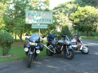
Route without Horizons - Gajah!!!
a combination of unfortunate events conspired to prevent me from putting this long awaited sequel down in the confines of history. in the end, a compromise was reached. now, my freaking computer is in chinese...so yeah...'my documents' became 'wo de wen jian' ... while ' control panel' became 'kong zhi tai'...the rest u figure urself..
speak mandarin campaign is really cool...
before i complain further, i think i better concentrate on getting day 2 out! the maps ain't ready cos i'm trying to figure out if i can install photoshop on this OS, will update it when it's done..so without further adieu...Route without Horizons - Gajah!!!!!!!!!!!!!
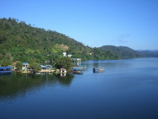
 morning on banding island
the five bottles of tiger were flat, still it was still potent enuff for all of us to drop dead upon reaching the bed, with reminders to wake up early to catch the sunrise over the mountain range fast disappearing into the numbing brain....
if i weren't so tired, the midnight orchestra might have kept me awake the whole night. but fortune would have it that i had just miss the sun rise. plans to wake up at 6, have breakfast and leave the resort at 9 evaporated as i woke..... at 8. the sun had just managed to pull itself clear over the range but a heavy fog still lingered at the heady altitudes of 1200 feet of Banding Island.
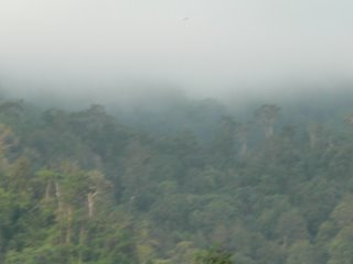 the heavy shroud
by the time we were ready, the prelude to a cloudless day was set with the sun shooting tiny missiles into our skin as we left the island to get some pictures over the exiting bridge.
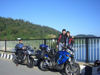 exit from banding island
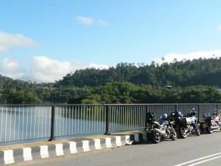 exit from banding
picture postcards scenery greets us all round the bridge as we search for sensory delights to prep ourselves for the coming hours.
 very postcardy
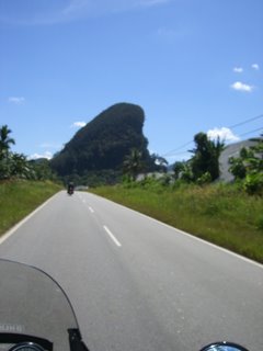
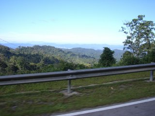
the route today would be really simple as much of the roads around the northern parts centre around the west-east highway, also known as the gerik highway in certain stretches. and southwards, we would head to gua musang aligning ourselves to the ever present peaks and knolls lining the road.
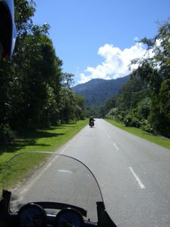 the wonderful roads
much of the journey would be pretty straightforward and it is a pleasant surprise that the weather isn't too hot to handle. perhaps the altitudes we were travelling on played an important part. the many twisties and winding roads reflect the times when the most economical way to build roads around mountainous regions was to go round them. however, we are in danger of losing these roads altogether, as the push for efficiency in the transport system prompts the local authorities every day to venture out new roads which are boringly as straight as a ruler. perhaps, the best time to enjoy these roads would indeed to be as soon as possible as bulldozers and tractors push down lands to make way for ' development'.
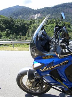
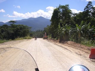 the shit we go thru sometimes...there are worser ones (fist sized rocks about a few inches thk)..but my poor dear was hanging on for dear life instead of whipping out the camera
 shark stone
nicely cornering in and out of the twisties with Jocleyne gamely filming us from the front bike, i was stuck in a monotonous trance when suddenly isaac e-braked for no reason! knowing the man and his amazing senses, i instinctly knew he had spotted something and to the right i turned my head. and i saw a freaking huge butt! the butt of a wild elephant just turning around and fleeing into the jungle. my vision became those of documentary films when pandemonium ensues when a cameraman or presenter caught something unawares.... i quickly braked and dear was still cutely unaware of wat was going on even when i shouted 'elephant!' thru my helmet.. i called her to disembarked and off i ran to the site. a wild elephant by the side of the road for god's sake. i've seen monkeys, chickens, goats and even seeing someone colliding into a cow but a wild elephant is totally something else. the excitement of seeing the rafflesia was already enuff for the trip...seeing a wild elephant is once in a lifetime...unless of course, ur in africa...
a ravine. the elephant disappeared from sight but the shaking of trees showed us where it went. gingerly, we climbed over the road rails and peered....lo and behold, a visibly shocked young asian bull elephant was peering back at us from the foot of the ravine. i felt a strange sense of safety since the ravine had a pretty steep slope..so any charge by the elephant would be slow and we're really about 30 to 50 metres away from it. cameras and video cams promptly appeared and captured this amazing moment.
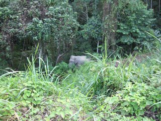
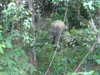 gajah the rajah
after tarrying a little while, the elephant walked off into the dense forest...and then trumpeted its mighty trunk as if to say goodbye. not once or twice but a succession of which we went off satisfied. already, this trip had much more than any i have been to.
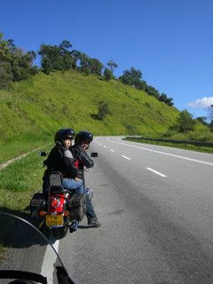
excitment gave way to hunger and breakfast or brunch was to be somewhere near the top of a peak where a small malay kampung thrived. the relaxing attitudes of the villagers calms the most nervous of souls as they amble into the food stall and have mini gatherings on a Friday afternoon. I immediately thot of wat i would have been doing had i been in singapore at work. simply nauseous.
 dear's fav sort of tree
a few kilometres out of the stall was a nice spot for more phototaking. dat said, it is very tiring to embark and disembark from a motorbike and i must salute my dear for taking every thing in her stride and gamely taking pictures and mementos everywhere. memories are made of these.
 the peaks along gerik highway to gua musang
gua musang is another interesting stretch of highway to lead us back southwards and soon we came across the 'famous' (famous among the avid trekkers i guess) Stong waterfall from the jeli- dabong highway intersection. it is a massive sight with water furiously lashing out to the ground with such intensity that is seems almost scary , even when we're about a kilometre away.
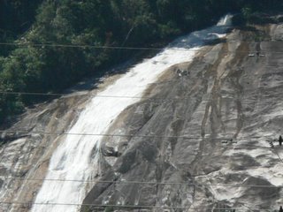 stong waterfall with its ferocious waters
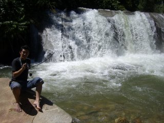
away we went again...taking in the sights as i tried my best to spot something out of the ordinary. about 80km from the stong waterfall, a bold sign labelled ' lata kertas' sprang out from the bushes and immediately we made a U turn. i, embarassingly, felled as my handle got locked out. i failed to notice that the road was inclined and with all the weight and excitement rumbling in me, i went in too rashly...
lata kertas means paper waterfall and we can see why. the entry route into the waterfall was steep and heavily potholed and jocelyne advised against going in. forunately, we did as we dipped into the cold waters of the waterfall, barely a few hundred metres in. the hot weather had drained much of our energy and i couldnt wait to get into the cool climate of Fraser's. meanwhile, this would do...
 lata kertas
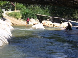 ah siong relaking by the pool
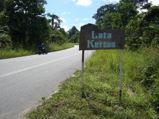 the sign that stopped us all
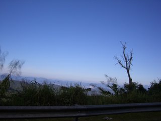
it would be 6 by the time we got up into fraser hill. the superbly narrow and winding roads leading up to fraser's is most stressful for a newcomer.
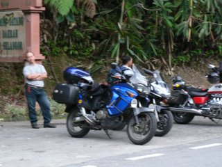 waiting at the Gap for the timing to go up..8km more!
every turn is an opportunity to plunge straight down into a seemingly bottomless ravine and the safety barriers are conspiciously absent in certain corners. odd hours are for vehicles heading up while even are for vehicles coming down. after 7, ur on ur own and i seriously doubt anyone in a right frame of mind would try it with the possilbility of another vehicle crashing into u in pitch dark surroundings.
 fraser view from the main gate
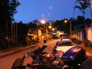
dinner is just at this quaint and ancient looking chinese restaurant which serves average food. but we were too hungry to bother anyway....
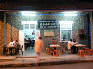 dinner
den another 5 beers from the mama shop plus a bottle of red wine. another end to a very tiring day.....with good company and cool air for company....Day three awaits....
wait up (not too long) for the final installation of : Route Without Horizons -TiTi!!!
speak mandarin campaign is really cool...
before i complain further, i think i better concentrate on getting day 2 out! the maps ain't ready cos i'm trying to figure out if i can install photoshop on this OS, will update it when it's done..so without further adieu...Route without Horizons - Gajah!!!!!!!!!!!!!
 morning on banding island
if i weren't so tired, the midnight orchestra might have kept me awake the whole night. but fortune would have it that i had just miss the sun rise. plans to wake up at 6, have breakfast and leave the resort at 9 evaporated as i woke..... at 8. the sun had just managed to pull itself clear over the range but a heavy fog still lingered at the heady altitudes of 1200 feet of Banding Island.
 the heavy shroud
by the time we were ready, the prelude to a cloudless day was set with the sun shooting tiny missiles into our skin as we left the island to get some pictures over the exiting bridge.
 exit from banding island
 exit from banding
picture postcards scenery greets us all round the bridge as we search for sensory delights to prep ourselves for the coming hours.
 very postcardy
the route today would be really simple as much of the roads around the northern parts centre around the west-east highway, also known as the gerik highway in certain stretches. and southwards, we would head to gua musang aligning ourselves to the ever present peaks and knolls lining the road.
 the wonderful roads
much of the journey would be pretty straightforward and it is a pleasant surprise that the weather isn't too hot to handle. perhaps the altitudes we were travelling on played an important part. the many twisties and winding roads reflect the times when the most economical way to build roads around mountainous regions was to go round them. however, we are in danger of losing these roads altogether, as the push for efficiency in the transport system prompts the local authorities every day to venture out new roads which are boringly as straight as a ruler. perhaps, the best time to enjoy these roads would indeed to be as soon as possible as bulldozers and tractors push down lands to make way for ' development'.

 the shit we go thru sometimes...there are worser ones (fist sized rocks about a few inches thk)..but my poor dear was hanging on for dear life instead of whipping out the camera
 shark stone
nicely cornering in and out of the twisties with Jocleyne gamely filming us from the front bike, i was stuck in a monotonous trance when suddenly isaac e-braked for no reason! knowing the man and his amazing senses, i instinctly knew he had spotted something and to the right i turned my head. and i saw a freaking huge butt! the butt of a wild elephant just turning around and fleeing into the jungle. my vision became those of documentary films when pandemonium ensues when a cameraman or presenter caught something unawares.... i quickly braked and dear was still cutely unaware of wat was going on even when i shouted 'elephant!' thru my helmet.. i called her to disembarked and off i ran to the site. a wild elephant by the side of the road for god's sake. i've seen monkeys, chickens, goats and even seeing someone colliding into a cow but a wild elephant is totally something else. the excitement of seeing the rafflesia was already enuff for the trip...seeing a wild elephant is once in a lifetime...unless of course, ur in africa...
a ravine. the elephant disappeared from sight but the shaking of trees showed us where it went. gingerly, we climbed over the road rails and peered....lo and behold, a visibly shocked young asian bull elephant was peering back at us from the foot of the ravine. i felt a strange sense of safety since the ravine had a pretty steep slope..so any charge by the elephant would be slow and we're really about 30 to 50 metres away from it. cameras and video cams promptly appeared and captured this amazing moment.

 gajah the rajah
after tarrying a little while, the elephant walked off into the dense forest...and then trumpeted its mighty trunk as if to say goodbye. not once or twice but a succession of which we went off satisfied. already, this trip had much more than any i have been to.
excitment gave way to hunger and breakfast or brunch was to be somewhere near the top of a peak where a small malay kampung thrived. the relaxing attitudes of the villagers calms the most nervous of souls as they amble into the food stall and have mini gatherings on a Friday afternoon. I immediately thot of wat i would have been doing had i been in singapore at work. simply nauseous.
 dear's fav sort of tree
a few kilometres out of the stall was a nice spot for more phototaking. dat said, it is very tiring to embark and disembark from a motorbike and i must salute my dear for taking every thing in her stride and gamely taking pictures and mementos everywhere. memories are made of these.
 the peaks along gerik highway to gua musang
gua musang is another interesting stretch of highway to lead us back southwards and soon we came across the 'famous' (famous among the avid trekkers i guess) Stong waterfall from the jeli- dabong highway intersection. it is a massive sight with water furiously lashing out to the ground with such intensity that is seems almost scary , even when we're about a kilometre away.

 stong waterfall with its ferocious waters
away we went again...taking in the sights as i tried my best to spot something out of the ordinary. about 80km from the stong waterfall, a bold sign labelled ' lata kertas' sprang out from the bushes and immediately we made a U turn. i, embarassingly, felled as my handle got locked out. i failed to notice that the road was inclined and with all the weight and excitement rumbling in me, i went in too rashly...
lata kertas means paper waterfall and we can see why. the entry route into the waterfall was steep and heavily potholed and jocelyne advised against going in. forunately, we did as we dipped into the cold waters of the waterfall, barely a few hundred metres in. the hot weather had drained much of our energy and i couldnt wait to get into the cool climate of Fraser's. meanwhile, this would do...
 lata kertas
 ah siong relaking by the pool
 the sign that stopped us all
 waiting at the Gap for the timing to go up..8km more!
every turn is an opportunity to plunge straight down into a seemingly bottomless ravine and the safety barriers are conspiciously absent in certain corners. odd hours are for vehicles heading up while even are for vehicles coming down. after 7, ur on ur own and i seriously doubt anyone in a right frame of mind would try it with the possilbility of another vehicle crashing into u in pitch dark surroundings.
 fraser view from the main gate
 dinner
den another 5 beers from the mama shop plus a bottle of red wine. another end to a very tiring day.....with good company and cool air for company....Day three awaits....
wait up (not too long) for the final installation of : Route Without Horizons -TiTi!!!
bitched Vanwacoireion the Elven Adventurer at 8:38 PM
![]()


<< Home