7am - Woke up several times last night. There was a moment in time when I thought I was going to suffer from a bad bout of fever. Luckily, I felt better after removing my outer layer and my knitted head wear. It was pretty hard to navigate under a thick blanket in such rapidly changing weather (or an overheating body!). As I head outside, we could see the marmots out in full force behind our tents, wrestling each other. Time for breakfast and onwards we go!
 |
| Marmots behind our tents! |
 |
| The marmots were really unperturbed by our presence to wrestle with each other! |
 |
| Goldrop's luxurious tents - really luxurious! |
 |
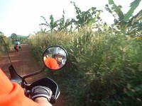
| Another one of those stops |
 |
| the good ladies at the foot of Tanglang La - the second highest motorable road in the world. With lots of vegetables and some medicine for Vippin, I'm sure he must have felt comforted. |
 |
| These thirsty workers asked for water. This is a terrible day job. |
 |
| Once in a while, a landslide occurs and these guys turn up, making sure the roads are clear for you...and more importantly, the Army. These roads lead to the highest battlefields in the world at Kargil and Pangong Tso (which we'll be riding to in a couple of days) |
1pm - we are now at the Moreh Plains, a vast expanse of dust and occasional vegetation at 4723m high according to my GPS. Just one more Pass to cross but also the highest of all in the journey to Leh, at an altitude of 5350m high. To get a sense of perspective, the altitude is at Everest Base Camp level, before climbers attempt their arduous ascent to Everest.
1145pm - the roads to Leh start to get exciting again after the stillness of the Moreh Plains as we began our ascent to Tanglang La, the second highest motorable road in the world. Breathing became obviously more difficult as the sea-level dwelling creatures could get use to the oxygen deficient rarefied air. Needless to say, we spent a short time there before heading back to our car to recover and catch our breath.
 |
| A bridge milestone with the name of the bridge and sometimes, warning signs |
The journey to Leh continues as we struggle to recover from the high altitude pass. The condition of the roads did not make it any easier. What were roads 2 years ago became rubble as a rare cloudburst last year caused massive erosion. We had to wait for the BRO workers to blow up a landslide before we could even pass. Through this journey, my impression of these workers also changed. While I had thought they only use basic tools earlier, the more complicated road repairs made use of the grouting method to strengthen the rocks beside the roads and heavy machinery to remove debris quickly.
 |
| Explosive power used to blow up a landslide - not far from Leh now! |
 |
| the roads to Leh are crusty, dusty and beautiful. The Silk Road travellers of yonder must have longed to get to Leh after a long, hard journey. |
 |
| and immediately after passing the truck, we get a puncture! |
 |
| How nice...:) |
 |
| Not a really bad place to get a puncture. |
 |
| Another road obstacle to get through |
After numerous checkpoints where we had our passports checked, we noticed big army camps in the region, indicating the sensitive border issue with several neighbouring countries. We reached Leh at 640pm and jostled with the evening traffic and the confusion created by one way traffic of the roads. Eventually, Isaac managed to speak to Tundup, our POC in Overland Expeditions, and headed to our lodgings in Leh. Over the next few days, Leh will become our base as we head out to the various sites around the region on both car and Royal Enfields. Boy oh boy, I can't wait!
The Border Roads Organisation is a symbol of Nation Building and National Integration and has become an inescapable component in maintaining the security and integrity of the Nation. Its pivotal role in constructing and maintaining operational road infrastructure for the armed forces in inhospitable, far flung border areas and contribution to the socio-economic development of the region has been legendry. Its ability during war has been repeatedly proven. This is the result of over 50 years of toil, unwavering dedication, unmatched professionalism and sacrifice of the officers, supervisors, subordinates and CPLs, from whom the organisation derives its strength.- www.bro.gov.in
BRO's ongoing project in Ladakh is HIMANK and they are really well-known for their humourous road signs in exceptional scenery.
http://en.wikipedia.org/wiki/Himank
 |
| A bridge milestone with BRO's logo |
 |
| "Welcome to the Paradise of India" indeed! |
 |
| "It's always better to be Mr Late than the Late Mr" |
 |
| "Virgin Nature of Ladakh is the Art of God" |
 |
| "Peep Peep. Don't Sleep!" - the roadsign that a coffeetable book of indian roadsigns was named after |
 |
| "Don't be Gama in the Land of Lama" - Gama means proud in Ladakhi |
 |
| "Drive on Horsepower, not on Rum Power" |
|
 |
| "Blind Curve Ahead, Check Your Nerve" |
 |
| :) |


<< Home